Aviation Apps
With the iPad so ideally suited to aviation, we examine today’s top apps
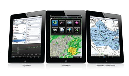 |
It's hard to believe that the iPad was introduced just in 2010. With an estimated 60 million iPads sold since Apple introduced it two years ago, no other device in history has influenced our world the way this clean little tablet computer has. And it has changed aviation in ways that surpass even the introduction of GPS to cockpits in the mid-1990s. In a recent announcement, United Airlines said they would begin rolling out iPads to all their pilots, realizing not only the advantages of broadband communication and some amazing aviation apps, but also saving money on fuel by not carrying reams of paper charts, approach plates and other paperwork. In aviation, the iPad is here to stay. The iPad has evolved quickly, and so have the apps that run on it. The apps that were hot in aviation yesterday may not be the best anymore. With such a fast- morphing computing landscape, we at Plane & Pilot wanted to examine 15 apps that all pilots should consider. Some are old friends that have been updated with new capabilities, and some are new to the iPad world.
 |
AeroWeather
www.aeroweather.ch
Yes, it's true that many aviation apps for the iPad have some kind of built-in weather information. The reason AeroWeather makes it to our list is because it has the clearest and most intuitive display format of all the dedicated weather apps. One glance allows you to look at weather from multiple stations at once. And the decoded TAFs are simply beautiful to look at. So many apps have great functionality but poor graphical presentation. With AeroWeather, much time was spent making the graphical interface just right, and it works flawlessly. Though the "Lite" version is free, the AeroWeather Pro ($3.99, one-time) adds webcam displays from nearby airports, NOTAMs, user-added comments for each station, email and print capability, Twitter and Facebook sharing, and an automatic "Nearby" feature that always shows weather in your area.
 |
ASA FAR/AIM
www.asa2fly.com
Neither sexy nor flashy, ASA's FAR/AIM app for the iPad is the best $9.99 pilots will ever spend. How many times have you been sitting somewhere and had a question about an FAA reg or something to do with airspace or pilot communication? Instead of scouring through eight pages of useless Google hits, pilots can turn directly to the official source right from their iPad. The app includes searchable indexes to Titles 14 and 49 of the Code of Federal Regulations (14 and 49 CFR), and the Airman's Information Manual (AIM). As of February of this year, the app also contains the Pilot/Controller Glossary. Free updates are included; $9.99.
 |
Control Vision Anywhere Map
www.anywheremap.com
Anywhere Map has been turning heads with their portable navigators for several years now, and I've been awaiting their entry into the iPad market. I'm happy to report the app ($79.99/year) has kept the features that made their portable GPS units so successful. Leading the charge is Control Vision's patented "Cones of Safety" that show which airports are within glide range based on the glide ratio of your aircraft. The app's "Personal Digital Copilot" keeps track of ground obstacles, warning when they pose a threat. It issues reminders for fuel-tank changes, time to descend and other routine tasks. What sets this app apart is its clean look and ease of use---especially its touch screen. Also, they don't charge for georeferenced charts.
 |
Enflight
www.enflight.com
While some of the bigger iPad app makers are offering increasingly complex apps that do everything, some developers like Enflight are concentrating on focused features. Their product ($149.99/year) is designed for flight planning without distracting bells and whistles. The result is a clean and elegant app for the iPad. What's different about Enflight is its depiction of your planned route. It uses "TAF Spirals" to visually show what the weather is forecast to do along your route. Using different colors, the "spiral" changes with the TAF forecast time. Pilots can intuitively see how the weather will change. Also unique, the colors are based on your personal minimums, which you set up in the app. With Enflight you can get a complete weather briefing, and one of the app's strengths is its high-resolution winds-aloft modeling and RAIM analysis. You can then download your flight plan to your handheld GPS device.
 |
FltPlan
www.fltplan.com
FltPlan for iPad makes it onto our list because it's the best free aviation app out there that has this many features. Still one of aviation's best kept secrets, this free app continues to improve with an even better user interface, faster performance and more features---like the ability to draw on charts and plates. It's a full-featured flight-planning tool that allows pilots to input VFR or IFR routes, displaying all the information needed to manage the flight. FltPlan includes complete weather briefings with radar, flight tracking, approach plates, high and low jet charts and sectional chart downloads, digital A/FD manager and nav logs. The app works in conjunction with the FltPlan.com website, though no internet connection is needed to use the app. The website allows pilots to easily transfer flight-plan routes, NavLogs and Weather briefing to or from the iPad for offline viewing. With the iPad's GPS, pilots can watch their aircraft's progress overlaid on different charts.
Flight Guide iEFB
www.flightguide.com
Airguide Publications has been publishing their Flight Guide for over 50 years, and it has become a staple in general aviation. With the launch of version 4.2 of their Flight Guide iEFB app for iPad (Pro-Plus subscription is $19.99/month, yearly discounts available), a slew of new features is introduced. Flight Guide now includes data on nearly 5,000 airports, compared to the 3,000 most providers have, and they're georeferenced. Version 4.2 adds NEXRAD overlay on planning charts and wireless integration with Garmin's new Guardian panel-mount GPS. Features include Civil Air Patrol gridded charts, Class B, C and D airspace graphics, and "panel" versions of
 |
charts---including legends, VFR corridors, etc. iEFB is based on a rich airport database depicting non-standard patterns, overrun lengths, runway lights and much more. Real-time traffic alerts are available with the Zaon PCAS XRX receiver and a wireless GPS unit like Flight Guide's own FLY-Wi.
ForeFlight
www.foreflight.com
ForeFlight ($79.99/year for Basic; $149.99 for Pro) keeps getting better with the announcement of two major new features. The first is rich support for external documents. It allows pilots to integrate a reference library of everything from checklists to complete A/FD documents into ForeFlight, with an easy way to store, find and manage those documents. The enhancement includes a document viewer that allows quick switching between Document view and other ForeFlight functions without changing apps, and an easy way to import any kind of document. ForeFlight's second enhancement was the talk of Sun 'n Fun. "Stratus" is a collaborative effort between ForeFlight, Sporty's Pilot Shop and avionics software developer Appareo Systems. Stratus is a portable receiver that wirelessly streams NEXRAD radar, text weather, TFRs and GPS position to ForeFlight on your iPad without a monthly subscription. Pilots place the postcard-sized receiver on their glare shield, connect to their iPad via WiFi (it supports connection to multiple iPads) and they have a load of weather information directly in ForeFlight without any wires.
Garmin Pilot
buy.garmin.com/shop/shop.do?pID=115856
Garmin has entirely rethought their popular Pilot MyCast iPad application, complete with a new name and a lot more utility. Though it will still feel familiar to MyCast users, Garmin's new "Pilot" app ($99.99/year for base app) has powerful new features, including preflight planning with fuel pricing, eye-catching layouts that better match Garmin's other systems, a touch-screen menu based on its higher-end navigators and better screen flow. In the air, the unit will display comprehensive weather information from U.S. and Canada, including NEXRAD radar, METARs, TAFs, AIRMETs, SIGMETs, PIREPs, visible and infrared clouds, NOTAMs, winds aloft, TFRs and lightning data by wirelessly connecting to XM WX Satellite Weather through the Baron Mobile Link paired with a satellite weather receiver (not included). Pilot lets users input their flight plan then view it on the moving map. Pilots can overlay weather and text-based "weather widgets" that show more data, and can pinch-to-zoom or pan across the entire route with NAV-TRACK. Pilots can also navigate with Garmin's patented Panel Page, a GPS-derived, graphical HSI directional display. The app interfaces with DTC DUAT and CSC DUATS so pilots can do block-to-block planning and filing. Garmin's Pilot is available in the iTunes app store with a free 30-day trial and works on iOS and Android-based devices.
 |
Jeppesen Mobile TC
www.jeppesen.com/jeppesen-mobile-tc
Jeppesen has a long history in aviation and continues that with iPad innovation to match their professional image. Jeppesen recently announced that they had completed rapid-decompression testing on the third-generation iPad as part of a program to persuade the FAA to certify the iPad as an approved EFB for use in professional cockpits. The FAA cited Jeppesen's newest Mobile TC (terminal charts) iPad app as a model for seeking certification, and allows the operator to use the iPad with the Mobile TC App as the sole reference for electronic charts, even during taxi, takeoff and landing. Jeppesen's Mobile TC chart viewer displays approach plate charts, terminal procedures, airway manual and airport diagrams, with more information coming on future releases. Jeppesen also announced enhancements to its Mobile Flite Deck app for the iPad (app is free; chart subscription varies by region). The app features new route-planning features including waypoint "rubber banding," and lock-screen capability to prevent data loss from accidental screen touches. Improved app symbols and faster performance were also announced.
 |
King Schools
www.kingschools.com
When it comes to world-renowned ground-school courses, John and Martha King are recognized for quality and results. We're pleased to see that King Schools is making their excellent courses available for the iPad. Users can purchase any online King course, then download an app called iSwifter from the iTunes store and view any King course (the download is required because King courses use Flash for animation, which isn't supported by native iOS on the iPad). Now, King Schools is offering iPad-ready courses directly from iTunes without requiring any additional download. Plus, they're being offered for only $29.99, even for the excellent "Pilot Communications" course.
 |
Logbook Pro
www.nc-software.com
Maybe like me you have an iPad, but your main computing platform is Windows. While LogTen Pro runs on Apple devices, Logbook Pro works with the iPad and Windows PCs and laptops. Also, this iPad app (it also supports Android and other mobile devices) is free. The PC software has a one-time cost of $69.95 (no subscription). Another thing unique to Logbook Pro is its use of "the cloud" for syncing data from one device across others, and for backing up your data. This option eliminates having to sync-up your devices using a wireless network and uploading data. When you make an entry, it updates to the cloud, allowing multiple devices to sync at any time. It also backs up your logbook data to the cloud, allowing access from anywhere, even after a device crash or theft. Logbook Pro is also infinitely customizable, tracks certificates, ratings, medicals and BFRs, and can import airline schedules. You can share flights in Twitter and Facebook, and it's even Windows 7 compatible.
LogTen Pro
www.coradine.com/logten-pro
While many applications are useful and full of features, some also are fun to use; and LogTen Pro ($99.99) is one of them. Easily one of the electronic logbook's strongest features is its extreme reporting capability. With more than 80 built-in reports, I spent hours slicing and dicing my flight time into countless groups and sub-categories. Plus, the canned stuff is beautiful to look at, with graphs for duty limits so professional flight crews can see and examine past, present and future schedules for excessive hours. The many features and displays can be customized to any level, and the software gets to know the fields you use, hiding what you don't need. It makes LogTen easy to use and very useful. The app's newest feature is its digital signature box. This allows instructors to sign their students' logbook entries with their finger directly on the iPhone or iPad. LogTen Pro syncs to Macs, iPhones or iPads wirelessly, so pilots can keep track of their time on almost any device.
 |
Sporty's "Learn To Fly"
www.sportys.com/PilotShop/product/17137
Sometimes an app comes around that's so useful you wonder why you didn't think of it first. Leave it to Sporty's to do that again with their Learn To Fly for the iPad ($249.99). The app includes everything from Sporty's famous Learn To Fly DVD and online courses, and leverages the iPad's gorgeous screen and portability to give student pilots real flexibility in learning. The app will run on your iPad and iPhone, and features 3D diagrams and award-winning video. In total, the app includes everything you need to become a private, sport or recreational pilot. Sporty's is so sure the course works that they'll refund your money in full if you don't pass all three tests after using the app.
Stenbock & Everson iChart
www.flightprep.com
A dedicated app for one task is sometimes better than an app that does many things. Such is the case with iChart from FlightPrep ($99.99/year chart subscription). Version 2.2 for the iPad is now available and has some great new features. iChart now includes GPS moving map on plates, charts and diagrams, along with seamless VFR and IFR charts for the lower 48 states and Alaska. It has easy to use "Favorites," "Nearest," and "Recent" functions, airport information, and a complete set of SIDs, STARs and Approach Procedures (IAPs).
 |
WingX Pro7
www.hiltonsoftware.com
Along with ForeFlight and Garmin's Pilot, Hilton Software's WingX Pro7 ($99.95/year; Synthetic Vision is additional $99.95; georeferenced charts add $79.99/year) is part of aviation's holy iPad triumvirate. An app that seemingly does everything in the cockpit well, it deserves its place on any "best of" list for aviaion apps. Until a recent announcement from ForeFlight, WingX Pro7 was the only app that displayed free ADS-B weather (including NEXRAD) when paired with an external ADS-B receiver unit. WingX Pro7 also can connect wirelessly to the ZAON PCAS portable XRX traffic system to provide real-time display of traffic on its moving map. One feature that clearly differentiates WingX Pro7 is its Synthetic Vision. A five-ounce add-on unit called an AHRS-G mini (made by Levil Technology) adds pitch and bank info so the synthetic vision becomes a big attitude indicator. The resulting display is clear and crisp, and can be a lifesaver and a backup to good flight planning. The $750 AHRS mini connects to the iPad wirelessly. Of course, WingX Pro7 also includes goodies like VFR sectional and IFR charts, georeferenced approach charts, TFRs, fuel prices, dual moving maps and everything else a pilot could ever need.

Subscribe to Our Newsletter
Get the latest Plane & Pilot Magazine stories delivered directly to your inbox

