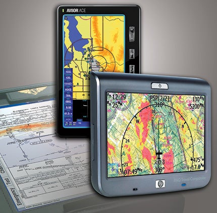
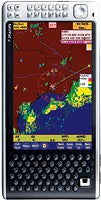
 From back to front, Advanced Data Research's FG-7100, Bendix/King's AV8OR ACE and Control Vision's Anywhere Travel Companion. |
Like many pilots, I carry a little insurance against the possibility of an alternator failure. I have a portable GPS on my Skylane's yoke, a handheld VHF NAV/COM in a seat-back pocket and a cell phone where I can reach it. With these, I've got backup navigation, communications and (in a pinch) weather information, all running on battery power and completely independent of the aircraft electrical system.
Some pilots go further, carrying portable GPS navigators that also receive signals from the XM satellite radio constellation for en route weather information. Pilots with deeper pockets might prefer a fully functional electronic flight bag (EFB) with computer-based charts. It's even possible to get portable devices for traffic avoidance and hook those into an EFB or GPS navigator to get something close to a full multi-function display (MFD) presentation.
GPS Navigators & EFBs
The fundamental decision when buying a device for navigation and weather avoidance is whether you want a dedicated GPS navigator or a full-blown EFB (basically a general-purpose portable computer that can be used for other purposes on the ground). Dedicated GPS navigators are designed and built to be used in the cockpit, with displays that work in bright light (and can be dimmed for use at night), dedicated buttons for common functions and mounting hardware for attaching the device to the aircraft yoke or glare shield. EFBs are based on general-purpose hardware, either a small personal digital assistant (PDA) or a larger Microsoft Windows--based tablet PC. Unfortunately, tablet PCs and PDAs weren't designed for use in the cockpit. Before buying any such device for aviation use, ask to see what it looks like outside on a bright day and also in very dim light. Many tablet PC backlights can't be turned down enough and can be blinding in a dark cockpit. EFBs also may not be as reliable as dedicated aviation GPS navigators. The same bugs (and even viruses) that bedevil desktop computer users can impact your EFB, especially if you use one of the more sophisticated models. Many vendors of EFB software recommend that you run only their software, with no other applications.
 Pilot MyCast from Digital Cyclone |
Beyond The Basics
Some, but by no means all, devices offer satellite-radio-based weather (which requires buying a compatible satellite radio receiver and weather subscription) and traffic (which requires a compatible traffic sensor). This is where EFBs have an advantage: They're general-purpose devices, so you can add weather or traffic to just about any EFB by purchasing the necessary hardware and an appropriate software package. Double-check to make sure they're compatible with your device, and remember that the more software you add to an EFB, the less reliable it's likely to be. If you want these features on a dedicated aviation GPS, you'll have to pay for them up front: only top-end models support them.
While you can't legally use any portable device as a primary navigation source for flight in instrument conditions, monitoring IFR procedures on a moving-map display is perfectly legal for situational awareness on Part 91 flights and provides a great emergency backup. Some devices offer a complete backup instrument panel, based on GPS position and/or input from an electronic gyro. In an absolute worst-case scenario (simultaneous electrical and gyro failure while IFR), that could save your life.
Also consider mounting and power when you select a portable navigation device---while the term "handheld" is widely used, in practice, you're better off with a hands-free mounting, whether on the yoke, lapboard, glare shield or in a "dock" on the panel. Most dedicated GPS navigators run on standard batteries and can also be run from a cigar lighter (if your airplane has one). That's a good solution for most pilots: Run off the aircraft electrical system and save the batteries for emergencies. EFBs, by contrast, almost always have rechargeable batteries and may require special adapters to run off the aircraft electrical system. If you fly only short hops, running off the battery is fine, but Murphy's Law says the one time you fly an unexpected extra leg will be on a day when you forgot to charge the battery!
 AirGator's NavPad 5 |
Handheld GPS, EFB & Weather Devices
The Advanced Data Research FG-7100 is an EFB built around a Fujitsu tablet PC running Microsoft Windows XP Tablet PC edition software. The computer offers an 8.9-inch, daylight-visible display with unique night-flight dimming control; touch-screen input; convertible form factor with built-in keyboard; 1.2 GHz Intel Core 2 Duo processor; 1 GB RAM; 80 GB hard disk (or 64 GB solid-state disk for high-altitude use); and built-in wireless connectivity. It comes with a three-year warranty (a one-year replacement warranty is available at extra cost). The FG-7100 is compatible with most flight-planning, moving-map and weather-avoidance software that runs on Microsoft Windows. Pricing starts at $4,995. Contact: Advanced Data Research, www.adrsoft.com.
AirGator offers the NavPad 5X and 7X---customized tablet PCs with sunlight-readable, nonglare, 4.8- and seven-inch (respectively), touch-sensitive displays; 1.3 GHz Intel Atom processors; 1 GB RAM; a 32 GB or 128 GB solid-state storage device running Microsoft Windows XP; wireless WAAS-enabled GPS and XM satellite radio receivers; and AirGator's NAVAirEFB software, which the company calls "the most intuitive, pilot-focused navigation and weather visualization solution on the market." The result is a complete EFB solution with moving map, aviation weather and georeferenced instrument approach plates. Pricing for complete bundles starts at $2,295. AirGator also offers higher-end EFB solutions for the business aviation market and software for pilots who already own a tablet PC or PDA. Contact: AirGator, www.airgator.com.
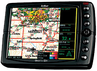 AvMap's GeoPilot II Plus |
AvMap's GeoPilot II Plus is a compact GPS navigator that can be used both in the air and for turn-by-turn navigation on the ground. It offers a wealth of pilot-friendly features, including a bright 5.6-inch color display, oversized control buttons and a unique thumb-stick cursor control. The customizable display allows a map view (with or without data fields) to be used alone or in combination with a simulated HSI/RMI presentation. A Jeppesen North America database is included with navaids, airports, low-altitude airways and terrain. Other features include flight planning, E6B functions, a built-in speaker, optional traffic display when used with a Zaon XRX portable collision avoidance system (PCAS) and optional aviation weather when used with a compatible XM satellite radio receiver (neither the PCAS nor XM receiver is included). Price is $899. Contact: AvMap, www.avmap.us.
The Bendix/King AV8OR is a shirt-pocket-sized device with a 4.3-inch, touch-screen LCD and integrated GPS. It has an aviation database with terrain, navaids, obstacles, airspace and airports, and an automotive database providing street-level maps, turn-by-turn navigation and a wide range of points of interest. The slightly larger AV8OR ACE, with a seven-inch display, is aimed at instrument pilots; it adds FAA National Aeronautical Charting Office (NACO) IFR en route charts, approach plates and airport diagrams (with own-ship position). The AV8OR ACE is priced at $1,999. Both models can display aviation weather data from an XM satellite radio receiver (not included), images and video, and can function as a hands-free kit for Bluetooth-compatible cell phones. Contact: Bendix/King, www.bendixking.com/av8or.
Control Vision's Anywhere Travel Companion is an air and ground navigation device built around a Hewlett-Packard iPaq 310 touch-screen PDA. It has a built-in GPS receiver and software offering aviation moving map with VFR, IFR and TAWS modes, instrument approach plates and optional aviation weather, if used with a compatible XM satellite radio receiver (not included). It also offers turn-by-turn navigation on the ground. Pricing starts at $595. MaxNAV VFR sectional charts are available at extra cost. Control Vision also offers similar software for Windows XP--based tablet PCs. Contact: Control Vision, www.anywheremap.com.
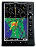 Garmin's GPSMAP 696 |  Hangar B-17's PalmEFIS |
Last fall, Garmin introduced its GPSMAP 695 and 696 models, which add a seven-inch portrait-format display and electronic charting to the already rich feature set offered by the previous top-of-the-line GPSMAP 495 and 496. All four units provide a complete aviation database with terrain, navaids, obstacles, airports, instrument procedures, taxiway diagrams and AOPA's Airport Directory. GPSMAP 696 adds an IFR map mode with a display similar to standard en route charts and includes electronic U.S. approach procedures, while GPSMAP 695 is available in versions optimized for use in North American, Pacific or Atlantic airspace. Like GPSMAP 496, GPSMAP 696 includes a built-in XM satellite radio receiver for aviation weather (which requires an XM satellite radio subscription), support for TIS traffic if you have a compatible Mode S transponder (not supplied with the unit) and turn-by-turn ground navigation with a wide range of predefined points of interest. All four models offer a GPS-based simulated instrument panel (that updates five times per second) for emergency use. The GPSMAP 696 retails for $3,595; the GPS695 goes for $2,895. The smaller GPSMAP 496 and 495 are available at lower prices. Contact: Garmin, www.garmin.com.
Hangar B-17's PalmEFIS, PocketEFIS and WinEFIS software applications turn PDAs and tablet PCs into GPS moving-map displays with flight planning, terrain, airspace, navaids, wind direction and emergency attitude-indicator functions. Unlike competing products, the Hangar B-17 software does this without an expensive electronic attitude gyro---only a compatible GPS is required. Aviation weather is also available with a compatible XM satellite radio receiver (not included). Software pricing starts at $210. The company also offers a variety of hardware bundles. Contact: Hangar B-17, www.hangarb17.com.
Midwest Sport Aviation offers FlightMaster Aviation GPS (formerly Aeropalm 3 GPS) software for PDA devices running the Palm operating system. Features include moving map with a Jeppesen database, terrain and conflict resolution, digital HSI, vertical navigation, waypoint search, turn anticipation, track log and night mode. The software costs $129. Contact: Midwest Sport Aviation, www.flightmaster.aero.
Handheld VHF NAV/COMs |
|
Icom's IC-A24 offers VHF NAV/COM functions, including a duplex feature that allows you to talk using the selected COM frequency while the unit displays a digital CDI showing deviation on the selected NAV channel. Other features include flip-flop recall buttons for the last 10 channels, 200-channel memory, a dedicated 121.5 MHz emergency channel button, an external power jack and optional rechargeable battery packs. The IC-A24 retails for under $325. Contact: Icom America, www.icomamerica.com. Sporty's SP-200 (pictured) is a $279 handheld VHF NAV/COM with localizer functionality, 8.33 kHz frequency spacing, 20-channel memory and CDI display with OBS function (plus external microphone, speaker and power jacks). Eight standard AA batteries provide up to 15 hours of continuous operation. A wide range of accessories is available at extra cost. The unit is covered by a five-year warranty. Contact: Sporty's, www.sportys.com. The Vertex Standard VXA-300 Pilot III offers VHF NAV/COM and FM weather radio receiver functions. It runs off a rechargeable battery pack (an overnight charger is included). Other features include a dedicated 121.5 MHz emergency channel button, 150-channel memory, scanner mode, CDI and optional public address function. The VXA-300 retails for under $270. Contact: Vertex Standard, www.vertexstandard.com. |
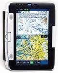 Stenbock & Everson's ChartCase Professional | 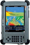 Mountain Scope from PCAvionics |
MountainScope software from PCAvionics turns a PDA or tablet PC with GPS into a moving-map display with flight planning, terrain, controlled airspace, instrument approach plates, airport diagrams and TFRs. With an optional electronic attitude gyro, MountainScope can provide a simulated attitude-indicator display. With an optional XM satellite radio, it can display aviation weather, and with external ADS-B or traffic receiver, it can display traffic on screen. Synthetic vision terrain view is available when running on a tablet PC. Pricing starts at $470. Contact: PCAvionics, www.pcavionics.com.
Stenbock & Everson's Chart Case Professional Version 5 software turns a tablet PC running Microsoft Windows into a Class 1 EFB with such features as in-cockpit weather (when used with a compatible XM satellite radio receiver), moving map (when used with a compatible GPS receiver), digital charting (including all U.S. sectional, WAC and low/high en route charts), approach plates and taxi diagrams, traffic (with an optional Zaon XRX receiver) and even GPS-based synthetic vision with Highway in the Sky (HITS). The software runs on any Windows-based PC with a 900 MHz processor and at least 512 MB RAM and 10 GB available disk space. Price is $449. The company also offers a variety of tablet PC hardware and accessories. A subscription is required for chart revisions. Contact: Stenbock & Everson, www.flightprep.com.
One-Of-A-Kind Portable Traffic Avoidance |
|
|
| 10 Pilot-Friendly Cell Phone Apps |
|
AeroWeather (www.aeroweather.ch) is a free international weather application for iPhones that offers METARs, TAFs and other information in English, German, French, Spanish and Italian. AirWX (http://airwx.com) is a completely free service that provides weather information, including METARs, TAFs and NEXRAD images, on any cell phone with a web browser. A $6.95 iPhone version adds sectional charts. Flight Control (www.firemint.com/flightcontrol) is a $0.99 (not a misprint!) iPhone game with an aviation theme, which the company describes this way: "Touch and drag your aircraft to their landing zones, and avoid midair collisions. It sounds easy, but as more and more planes arrive, you will need smart strategy, keen eyes and a smooth steady-as-she-goes touch!" Warning: This app is highly addictive. FltPlan.com has created a completely free Airport/FBO Info Guide (http://wh83.fltplan.com/iPhoneInfo.htm) for iPhones that gives a wide range of airport data, updated weekly. ForeFlight (www.foreflight.com) offers Airport/Facility Directory, checklist and sectional chart functions, as well as flight-plan filing on iPhones for $74.99. Hangar B-17's SmartEFIS (www.hangarb17.com) exploits the iPhone's built-in accelerometers to demonstrate emergency attitude-indicator functionality for $9.95. Upgrade to a fully functional GPS-based backup PFD for $249. Hilton WingX (www.hiltonsoftware.com) provides DUATS weather, weight and balance, FAA NACO-standard instrument approach procedures, route planning, E6B calculator functions and a raft of other features on iPhones, BlackBerrys and Windows Mobile devices. Laminar Research is offering an entire series of iPhone versions of its popular X-Plane flight simulator (www.x-plane.com). Practice flying everything from a Cessna 172 to a space shuttle, each for $9.99. LogTen Mobile (http://coradine.com) is a free app that turns an iPhone into an electronic logbook (pictured above) with advanced functions, including automatic tracking of currency and duty limits. It synchronizes wirelessly with the $99.95 LogTen Pro desktop application. Pilot MyCast from Digital Cyclone (www.digitalcyclone.com) provides complete weather briefing information (including animated NEXRAD weather radar) and flight-plan filing on more than 100 phones (including BlackBerrys and Windows Mobile devices---it should also be available for Apple's iPhone by the time you read this) and all major U.S. cellular carriers. It's sold on a subscription basis for $9.95 per month. |

Subscribe to Our Newsletter
Get the latest Plane & Pilot Magazine stories delivered directly to your inbox

 If the alternator fails in controlled airspace, there's no substitute for voice contact with ATC, and access to VORs and localizers can be a lifesaver. All three products in this section offer NAV and COM functions, including five-watt transmitter power (the maximum legally available) for voice communications.
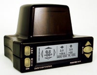 While a wide range of portable collision avoidance devices are available, Zaon's PCAS XRX ($1,495) truly is in a class by itself. The company calls it "the first-ever portable, passive, stand-alone collision avoidance system for general aviation to offer direction from within the cockpit." The XRX's integrated display gives relative position for up to three transponder-identified targets (prioritized by risk of collision) and shows you which way to look. When used with a compatible EFB or GPS navigator, the XRX can provide MFD-like traffic displays without the expense involved in panel-mount solutions. Contact: Zaon Flight Systems,
 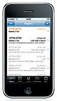 One major change this year is in the number of applications that provide graphical weather, flight planning/filing, emergency attitude indication and other functions on cellular telephones, including Apple's iPhone.