Weather-Avoidance Assistance
You can’t always rely on air traffic control for climate briefings
While the primary duty of controllers is to separate and direct traffic, they also have a duty to help pilots avoid weather hazards. The FAA's handbook for controllers requires them to issue pertinent information on observed and reported weather, provide radar navigation guidance and/or approve deviations around weather when requested, define where significant weather is located in relation to an aircraft, issue the level of echo intensity and help pilots figure out the best alternative routes and altitudes to avoid weather. On rare occasions, however, National Transportation Safety Board investigators discover that things don't always go by the book, as was the case in this investigation, which was completed earlier this year.
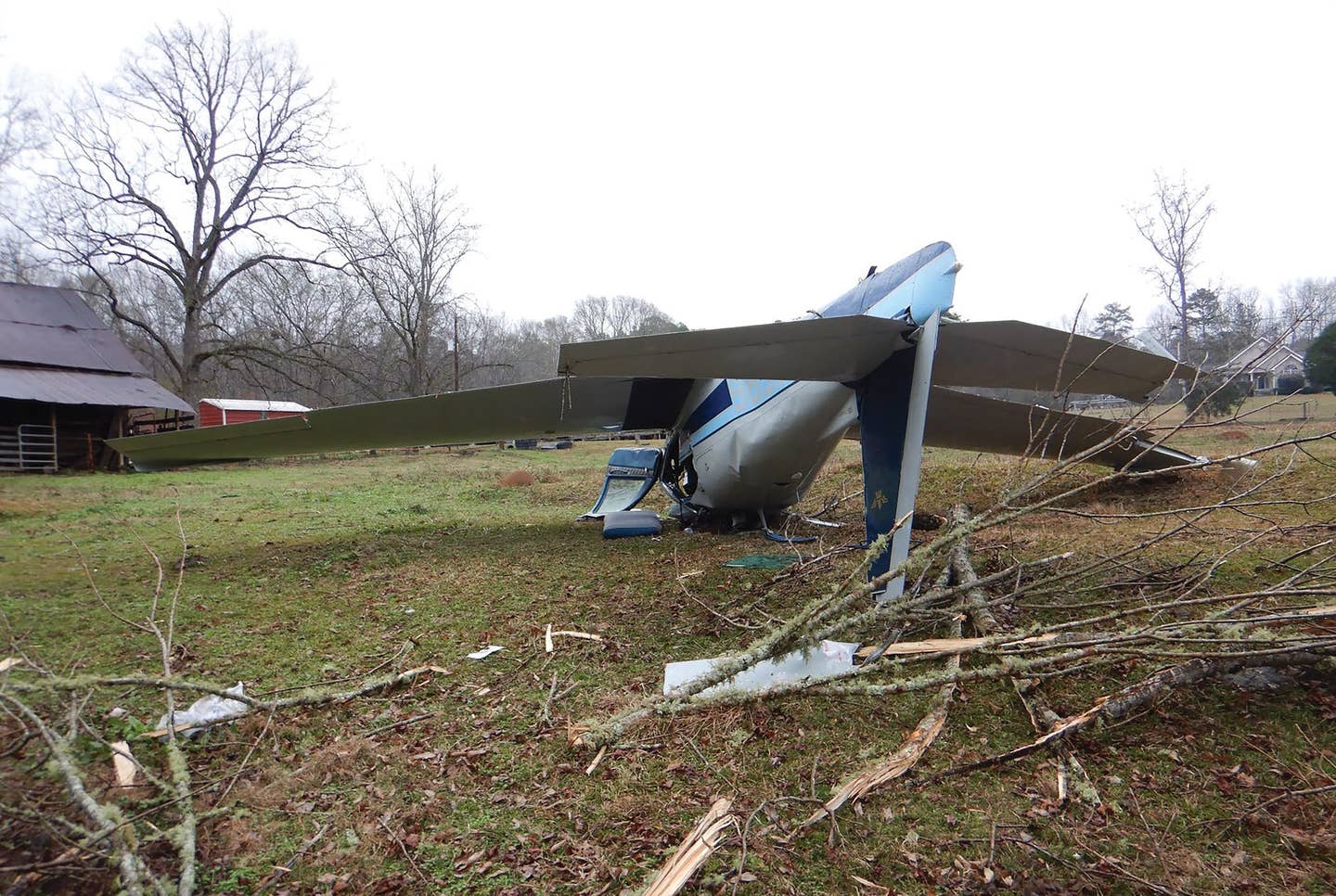
On May 31, 2004, at 2 p.m., EDT, an amateur-built Lancair, with a private pilot at the controls, crashed following a loss of control during cruise flight near Vermontville, Mich. Instrument meteorological conditions with thunderstorms were present at the time of the accident. The business flight was operating under Part 91 on an IFR flight plan. The pilot and both passengers were fatally injured. The flight departed Willow Run Airport (YIP), Ypsilanti, Mich., at 1:30.
At 12:13, the pilot telephoned the FAA's Lansing Automated Flight Service Station, requesting a weather briefing for a flight from YIP to Portland International Airport (PDX) in Portland, Ore., with an en route stop. The briefer advised the pilot to expect thunderstorm and rain shower activity in Michigan, moderate turbulence below 9,000 feet MSL and icing conditions between 7,000 and 14,000 feet. The briefer also described an area of thunderstorms extending from south of Milwaukee (MKE) through the Chicago metropolitan area and extending almost to the Iowa border. A SIGMET, which was current at the time, reported a developing area of thunderstorms moving from the west at 30 knots, with tops reaching 28,000 feet. The briefer advised the pilot to contact Flight Watch or flight service after the departure for assistance in avoiding this adverse weather.
When asked where he planned to stop en route to PDX, the pilot replied, "Why don't we plan on Billings [Montana]?" The briefer advised that there were numerous notices to airmen in effect for Billings Airport (BIL) and its associated approach procedures. The pilot then filed an IFR flight plan from YIP to BIL via MKE, requesting a 10,000-foot cruise altitude.
The pilot contacted Lansing Approach at 1:41 while climbing to 10,000 feet. At 1:44, the Lansing Approach controller asked if the aircraft was equipped with weather radar. The pilot responded that it was not, and the controller advised the pilot of weather ahead that might affect the aircraft's flight. The pilot requested vectors around the weather.
At 1:45, the Lansing controller used the interphone system to ask a controller at Grand Rapids Approach Control to see if he could provide further information on the extent and intensity of the precipitation. The Grand Rapids controller was unable to assist at that moment due to workload, but said that he would call back. The Lansing controller then issued the pilot a 270-degree heading to avoid the weather depicted on the Lansing Approach displays.
During this period, the aircraft climbed above its assigned altitude of 10,000 feet twice, at one point, reaching 10,800 feet. At 1:49, the pilot requested to climb to 11,000 feet because it was "pretty bumpy" in the clouds. The Lansing controller told the pilot to expect 12,000 feet, but to remain at 10,000 feet pending coordination with other controllers.
At 1:50, the Lansing controller completed an automated handoff to the Cleveland Air Route Traffic Control Center. The Lansing controller advised the Cleveland Center controller that the airplane was on a 270-degree heading to avoid weather and relayed the pilot's request for 12,000 feet. At 1:51, the Cleveland Center controller cleared the pilot to climb to 12,000 feet and instructed the pilot to proceed direct to Milwaukee when he was able, but did not provide any information about radar-observed weather ahead of the aircraft.
Data showed that the accident aircraft turned from the previously assigned 270-degree heading about 20 to 30 degrees to the right, putting it on a direct course toward MKE. At 1:51:41, the Cleveland Center controller advised a Chicago Center controller that the airplane was proceeding direct to MKE and had not requested any weather deviations. The Cleveland Center controller also told the Chicago Center controller that the Chicago Center would have control for any weather deviations and that the pilot had been having trouble holding altitude while at 10,000 feet MSL. The flight was handed off to Chicago.
At 1:54:06, the Chicago Center controller radioed to see if the pilot was on frequency and asked the pilot to verify his altitude. The pilot stated that he was at 11,900 feet. At 1:54:55, the Chicago Center controller told the pilot to report reaching 12,000 feet, which the pilot complied with at 1:55:02.
At 1:58:34, the pilot transmitted, "Center, what do you show us in up here?" The Chicago Center controller twice asked the pilot to repeat his message, with no immediate response.
Aircraft radar track data was plotted on a weather radar chart that depicted areas of precipitation and their corresponding intensities. The plotted data showed the accident airplane flying into an area of level-six thunderstorm precipitation at 12,000 feet prior to a rapid loss of altitude.
At 1:59:09, the pilot transmitted, "SOS, I've got something wrong with the flight controls."
At 1:59:16, the Chicago Center controller responded, "Go ahead. Let me know what you need."
At 1:59:19, the sound of an open microphone was heard on the frequency for 12 seconds.
At 1:59:40, the pilot said, "Chicago Center, we're [going in. I] can't maintain altitude."
At 1:59:53, the controller responded, "Roger, there's no aircraft between you and the airport [unintelligible] for Grand Rapids. Grand Rapids is approximately 12 o'clock about 15 miles." There were no further contacts with the airplane.
At 2:00:04, the Chicago Center radar associate controller contacted Grand Rapids Approach Control to coordinate emergency information on the airplane. He reported that the aircraft had been at 12,000 feet, but appeared to have departed that altitude. At 2:00:47, the Chicago Center radar associate told Grand Rapids Approach, "Twenty to 25 southwest of Lansing!looks like we've gone to a primary [radar return, no transponder] only. It looks like he's right in the middle of that cell." The Grand Rapids controller reported that he could see a weather cell at the location provided by Chicago Center for the aircraft.
The Chicago Center controllers contacted other controllers and radioed other aircraft in the area for assistance in locating or reestablishing contact with the Lancair. At 2:14:54, Grand Rapids Approach Control advised Chicago Center that the Eaton County police were investigating a report of an aircraft accident near Vermontville, Mich. The wreckage site was subsequently located by the police and confirmed to be the accident airplane.
The pilot held a private-pilot certificate with single-engine land and instrument airplane ratings. According to the last logbook entry, the pilot had a total flight time of 1,073.8 hours. The pilot had reportedly flown approximately 65 hours in the accident airplane and had 107 hours of instrument time.
During an interview with the Cleveland Center controller, investigators asked what he meant by telling the pilot to proceed direct to Milwaukee when able. The controller responded that he believed it was better to allow the pilot to go on course and give the Chicago Center control for possible deviations around any weather that they were showing on their displays. The Cleveland Center controller confirmed that he saw weather about eight to 10 minutes ahead of the accident airplane and acknowledged that the Lansing controller had placed the airplane on the 270-degree heading to avoid weather. The Cleveland Center controller stated that he generally allows pilots to make any weather deviations based on the weather information that he relays.
The NTSB determined that the probable cause of this accident was the Air Route Traffic Control Center controllers not providing weather-avoidance assistance as required by FAA directives, resulting in the airplane flying into a thunderstorm and the pilot not being able to maintain aircraft control. A factor in the accident was the thunderstorm.
Peter Katz is editor and publisher of NTSB Reporter, an independent monthly update on aircraft accident investigations and other news concerning the National Transportation Safety Board. To subscribe, write to: NTSB Reporter, Subscription Dept., P.O. Box 831, White Plains, NY 10602-0831.

Subscribe to Our Newsletter
Get the latest Plane & Pilot Magazine stories delivered directly to your inbox


