Accident Briefs: September 2018
A report from the NTSB about a Cessna 182D accident.
NOTE: The reports republished here are from the NTSB and are printed verbatim and in their complete form.
CESSNA 182D
South Lake Tahoe, CA / Injuries: 1 Fatal
The noninstrument-rated private pilot was returning to his home airport along a mountainous route that he had traveled multiple times in the accident airplane. After landing for fuel at an intermediate airport, he called his wife and reported that the landing was challenging due to strong winds. He subsequently departed on the final leg of the flight, and shortly after departure, he sent her in-flight photographs which revealed limited visibility, dust storms, and lenticular cloud formations in the general direction of his intended route.
The flight progressed on a relatively constant track for the next 2 hours, during which time the airplane encountered significant headwinds, which reduced its ground speed to about half of its typical cruise speed. As the airplane approached the high terrain of the Sierra Nevada mountain range, the flight track began to deviate left and right with rapid climbs and descents. During the last 1.5 minutes of flight, the airplane descended from 10,800 ft to the last radar-recorded altitude of 9,700 ft.
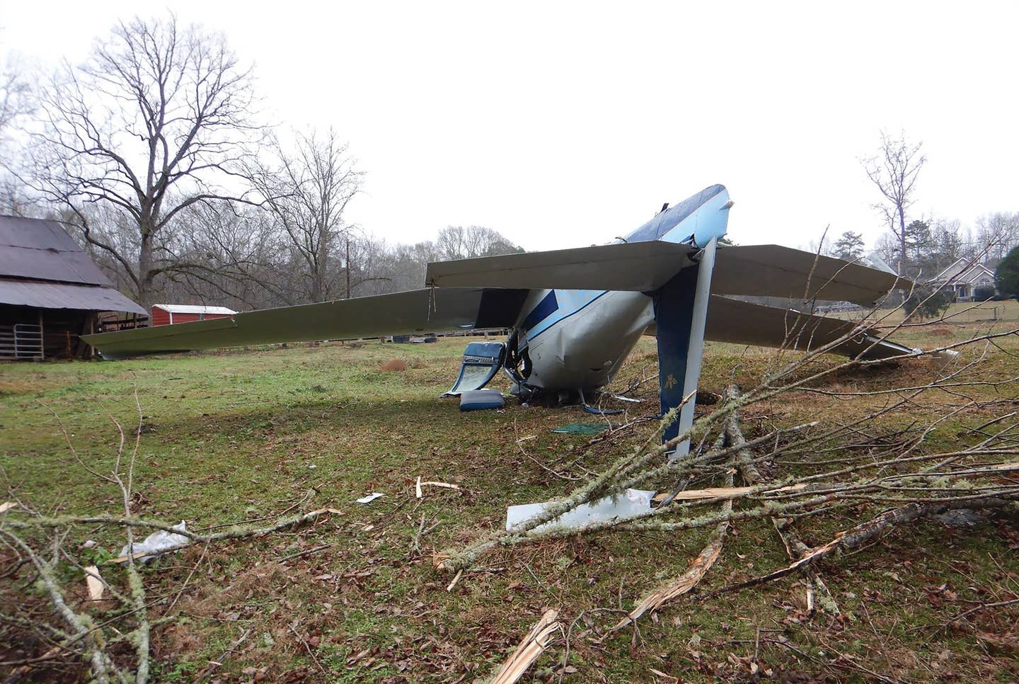
Snow, rain, and strong wind hampered the search effort, and the wreckage was found 3 days after the accident covered in snow at an elevation of 8,630 ft, about 3,300 ft south of the last radar target and about 50 miles short of the destination airport. The debris field and airframe damage was consistent with a high-speed, right-wing-low impact. The airplane was equipped with a 406MHz emergency locator transmitter (ELT), which should have provided search and rescue teams with an accurate location of the wreckage, however, due to the severity of the impact, the ELT detached from the airframe and thereby its antenna. The pilot's injuries were determined to be non-survivable.
Examination of the airframe and engine did not reveal any anomalies that would have precluded normal operation.
About 30 minutes before the accident, an air traffic controller issued the pilot a frequency change, which the pilot read back correctly. Although the airplane's flight path continued, the pilot never made radio contact with the next controller, and neither that controller nor the previous controller was able to reach the pilot despite numerous attempts. It is possible that, during this portion of the flight, the pilot was occupied with maintaining control as the airplane began to experience the effects of downdrafts and mechanical turbulence while approaching mountainous terrain from the lee side.
A storm was passing through the area at the time of the accident with high winds, mountain obscuration, and precipitation; these conditions were both predicted and widely disseminated in published weather products. Weather analysis revealed that, during the final minutes of flight, the airplane likely either entered or was drawn into instrument meteorological and airframe icing conditions after encountering downdrafts with velocities that exceeded the airplane's climb capability. It could not be determined whether the impact was the result of spatial disorientation after entering Page 2 of 4 WPR17FA008 the instrument conditions, the encounter with downdraft conditions, or some combination of the two. Additionally, the pilot did not use his shoulder harness, and his lap belt appeared to be loose at the time of impact. He had struck his head on the cabin roof during a prior turbulence encounter, so it is possible that this happened again, leading to some form of incapacitation during the final minutes of the flight. Furthermore, none of the airplane's cargo, including folding chairs, water canisters, coolers, tools, and clothing had been secured. These items most likely began to shift during the downdraft encounters, possibly becoming a distraction, or even interfering with the pilot.
Although the pilot did not receive an official weather briefing before the accident flight, he was likely using a tablet-based mobile application and ADS-B device that would have provided him with weather information; additionally, conversations with his wife about the flight and interactions with air traffic control personnel regarding a temporary flight restriction (TFR) in the area indicated that he had a source of aviation weather and flight information. After departing on the flight, the high wind conditions were apparent to the pilot given the airplane's slow ground speed, and the lenticular cloud conditions reflected the presence of mountain wave activity. Additionally, pilots on the air traffic control approach frequency that the pilot was tuned to were discussing landing options given the high wind conditions in the area. The presence of clouds at and above his flight level during the latter parts of the flight would have been obvious to the pilot.
The worsening weather conditions in the region (in particular the extreme surface winds at area airports), along with the TFR, which was located just below the final segment of his route before crossing over a large lake and into remote, mountainous terrain, may have contributed to the pilot's reluctance to discontinue the flight and land. Additionally, his familiarity with the area and route, along with the relative close proximity of his destination, may have lulled him into a false sense of security, predisposing him to continue the flight.
Probable cause(s): The noninstrument-rated pilot's decision to depart on and continue a flight over mountainous terrain into forecast instrument metrological conditions, icing, and hazardous wind conditions that exceeded the airplanes performance capabilities and resulted in an uncontrolled descent and collision with terrain.

Subscribe to Our Newsletter
Get the latest Plane & Pilot Magazine stories delivered directly to your inbox


