From The Ground To The Tropopause
Turbine flying, weather and learning something
 |
When I was gaining experience in my first turbine airplane, I was checking the weather for our next flight, and my high-time, former airline captain mentor-pilot walked in joking that in the airlines, they used to say checking the weather wasn't worth much because, heck, we were going anyway! On the very next leg, we battled 100+knot headwinds, diverted because of low fuel, and then made a circling approach to minimums at night in a snowstorm at an airport in the mountains and rolled to a stop covered in ice. It was a memorable and pretty exciting experience for both of us, and I sure learned a lot---mostly about what not to do. I'm pretty sure that my mentor gave up on that casual approach to weather planning on the spot.
As owner-pilots, we're pretty much on our own when it comes to gaining firsthand weather experience, and there's often a fine line between learning something and getting in over your head. That's particularly true as you move into flight levels with higher-performance airplanes. It doesn't take long to learn that the old saying that turbines fly "above the weather" isn't always exactly true. "Getting above the weather" often means that you get to experience all of the low-level weather along with a lot of various other weather issues that occur higher in the atmosphere. Sure, there are times when you might be cruising up in clear, smooth skies while the folks down below are slugging it out in IMC with rain, ice and turbulence, but there are other times when the weather at higher altitudes might be just as serious.
On one hand, most turbine airplanes are equipped to handle a lot more weather than the less complex airplanes that we start with, but on the other hand, you've got to learn how to use the equipment, learn what it can handle and know when to use it. Unfortunately, very few formal training programs focus on this stuff, so this is where mentor time can be really valuable. A little fear, a big helping of good sense and some thoughtful planning are the keys to safely gaining weather experience as you move into flight levels. Weather and meteorology are big subjects and, in the end, it almost doesn't matter how much experience you have; you'll never get to the point where you know it all. So, let's take a brief look at a few weather issues that are relevant to turbine operators with the goal of providing some things to consider as you move up.
Listen And Learn!
One of the first things that you'll learn as you head into the flight levels is that the number-one thing that airline crews are talking about on the radio is the weather, and there's a lot that you can learn! The most common subject is "the ride." How's the ride in the climb? What's the ride in the descent? What altitude has the best ride? Remember, airliners have flight attendants moving around the cabin, and the flight crews are working hard to keep things safe by keeping things smooth. When you hear a report of moderate turbulence from an airliner, pay attention. Transport-category airplanes have much higher wing loading than most of the light aircraft flown by owner-pilots, and a report of moderate turbulence is something to pay attention to. If it feels "moderate" to an airline crew, it's definitely going to get your attention.
I've only heard a report of "severe" from an airliner one time, and it happened while I was at FL280, in IMC, experiencing "severe turbulence" myself. Trust me, "severe" is something to avoid it all costs---it's very serious stuff. In our TBM 700, that meant flying at Va with the stall horn blaring on and off while performing almost continuous upset recovery on instruments for nearly 25 minutes until we flew out the backside of that system. I was soaked, and my passenger had eyes like saucer plates by the time things finally calmed down. It doesn't happen very often, but if you see the word "severe" attached to any forecast for turbulence, don't even consider going there. That's one reason the word "severe" will appear in a SIGMET, not an AIRMET.
Just Don't Go There!
During the spring and summer, you'll also hear airline crews requesting to deviate for weather, and the message is pretty obvious. If an airline crew doesn't want to go through the top of a building cumulus, neither should you. There's nasty stuff going on in those building storms that can be pretty unpleasant and at worst, fatal. The NTSB accident database is loaded with stories about what happened to aircraft piloted by those who ignored this simple rule, and it includes aircraft of every category. The big towering clouds that go to 50,000 or 60,000 feet are pretty obvious and so are the clouds loaded with lightning.
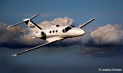
The more difficult situations happen when things aren't quite so obviously nasty-looking. One time, while cruising at FL410 in a Citation, I sailed over the top of an extensive spring storm system that was widely spread over the middle of the country. NEXRAD showed concentrated lightning activity ahead, but it looked like I was nearly 5,000 feet above the tops. What was hard to tell was that the tops were slowly rising as I traveled toward what turned out to be the middle of an embedded storm. As I reached the storm center, the tops had risen to be less than 1,000 feet below, and suddenly, all that storm energy unleashed a violent column of turbulence that lasted for about 20 minutes. We were lucky, there wasn't any hail, but the turbulence served as a dope slap to remind me that going over the top of any convective activity with less than a mile of vertical clearance wasn't very smart. Rapidly growing areas of convective activity can throw significant amounts of ice into the clear air above, and it's best to go around rather than over those areas.
Watching from a distance how a storm develops over time on NEXRAD can provide useful information about how to plan a deviation as you get closer. The old wisdom of giving wide berth to thunderstorms is as valuable up high as it is down low. If you can't go way over the top with at least a mile of vertical clearance, go around and always avoid flying under an anvil. Tools like NEXRAD (for long-distance strategic decisions), lightning detectors and onboard radar (for closer real-time information) are essential for maintaining safe separation from convective activity when you're in IMC. Knowing the strengths and limitations of your equipment should be gained through good-quality instruction and a cautious approach in difficult conditions. Don't expect to power up your onboard radar for the first time when you really need it and expect to get anything useful out of it!
How To Feel Good About A 90-Knot Headwind
The jetstream is one of the first things we all hear about high-altitude operations, and a turbine aircraft is the best way to experience the victory and the heartbreak of the phenomenon firsthand. The "jet" has winds of at least 50 knots that generally flow west to east, and it's stronger and moves farther south in the winter. Jetstream winds can start in the mid-20s and extend well above FL400. Unless you're operating at pretty high latitudes (like over the arctic regions), you've got to climb pretty high to get above the winds, so unless you can get to FL500 over the continental U.S., you're probably going to have to deal with jetstream winds.
It almost doesn't matter how fast you go for the jetstream to have a significant impact on your flight planning. I recently discovered on a long trip from Tennessee to Oregon that just about the only way for a 90-knot headwind to seem like a good deal is to start out with 160 knots on the nose! Needless to say, all that wind has a significant impact on range and fuel planning. It doesn't take long to learn that high-altitude winds can make for tremendous range headed eastbound and for a lot of stops going in the other direction.
The other thing the jetstream can do is to create a lot of turbulence. Checking the high-altitude winds on the ADDS site (www.aviationweather.gov/adds/winds) can reveal a lot of what to expect. Anytime you see the jetstream take a big turn or show a sharp boundary between wind speeds, you can expect turbulence. When warm air from the south collides with colder northern air near the jetstream, it can produce clear air turbulence (CAT)---most often on the polar side of the jetstream.
Mountain wave CAT interacts with jetstream winds due to the mix of low-level winds and high mountains. It can extend 100 nm from the peaks and affect altitudes up to a mile above the tropopause. Mountain wave often has a long wavelength and can sometimes cause significant airspeed variations. I've experienced an increase in true airspeed that required pulling the power back to avoid going over speed for as long as 10 minutes in a very long period mountain wave at FL400. Unless you know what's causing it, it seems very mysterious to notice that your airplane is going way faster (or slower) than it should!
One minor oddity about the jetstream is that it's often possible to have significant headwinds on an outbound trip only to find that the jetstream moves around in such a way that you get to experience almost the same headwinds on the trip back home. This almost never works in reverse, and we can all thank a guy named Murphy for this effect.
High-Altitude Temperatures And Performance
It's important to understand that the performance of all turbine engines is strongly affected by temperature, and this becomes particularly important when operating a turbofan aircraft. Most light jets climb like crazy up through about FL300, and after that, the climb rate starts to steadily decrease. It's not uncommon to level off at cruise altitude after climbing at only 150-300 fpm for the last 1,000 feet, so in most jets, it becomes very important to check temperatures at altitude. If it's hot enough, you might not be able to even get to your planned cruising altitude! The ADDS winds and temperature page makes this easy with charts that show temperature at various altitudes relative to International Standard Atmosphere (ISA). In my Mustang, anytime the temperature is more than about ISA+5 above FL360, we give up on trying to get above FL390. The performance when the airplane is heavy and it's hot at altitude is just too anemic to go that high. This is a great tool for planning final cruise altitudes. One thing you'll quickly realize is that the temperature in the high atmosphere doesn't have much to do with the season. It can be tremendously hot up high when it's cold on the ground and vice versa.
Icing On The Cake
One of the facts about cruising in the flight levels is that you need to get up there and, eventually, you need to get back down, and that can mean encounters with ice. Turbine airplanes ice up just as easily as piston airplanes; however, most turbine airplanes are equipped with more effective anti-icing and deicing systems designed for operation in known icing conditions. Turbine airplanes typically have enough excess power to rapidly climb through most icing altitudes. Still, a TBM accident in 2011 provides a sobering reminder that no matter what you fly, it takes respect for icing conditions to stay out of trouble. The pilot of N731CA took off into icing conditions predicted to be moderate and reported as severe by pilots in the area. The plane iced up and stall/spun while trying to climb out of the ice. Remember that severe icing is defined by accumulation so fast that it completely overwhelms any anti-ice or deicing system. Even moderate icing conditions can challenge most aircraft capabilities if you're in it for a long enough period of time. One thing you can do to improve the effectiveness of deice boots and prop heater pads is to periodically coat them with BF Goodrich IceX---it does work.
Ice typically forms in visible moisture when the temperature is between +5 and -20C (and sometimes colder), but most of the time, it occurs between +2 and -10C. The tops of the clouds are often the best place to find the worst icing conditions. There are a few things to remember when you encounter ice. First, your POH will provide minimum speeds for operations in icing conditions. This is done to make sure that ice doesn't accumulate in unprotected areas on the airframe. Second, make sure that you have all of your anti- and deicing systems turned on, and check that they're working before you need them. As you enter visible moisture and ice starts to form, periodically check the wings and tail (if you can see it) to check the accumulation, and do what you can to exit the conditions as soon as possible. If ice is building so rapidly that you can't control it, don't be shy about doing something about it. If controllers won't immediately clear you to a different altitude, simply declare an emergency and do what you need to do to exit the conditions by climbing or descending. Ice accumulation that you can't control is an emergency that can rapidly get out of hand.
Perhaps the most dangerous situation in icing conditions is tailplane icing. Every pilot should watch the outstanding NASA video on this subject available on YouTube at: www.youtube.com/watch?v=_ifKduc1hE8. This is a must-see educational video that every pilot who operates in icing conditions should watch.
Remember that if you unexpectedly pick up a load of ice on an approach, you've become a test pilot flying an untested wing that's probably carrying a lot of extra weight. You have no idea how the wing will stall, so avoid any configuration changes, make shallow turns and keep your speed up all the way to touch down.
Operations in snow country also require an intimate knowledge of deicing procedures and holdover times (HOTS), but that's a subject a bit beyond a simple discussion of weather issues. The one big take away is that you must take off "clean." There can't be any ice, snow or frost on the aircraft.
Good Sense And A Little Luck
Last summer, I experienced a new phenomenon while departing EAA AirVenture. Our departure slot was for 2:30 p.m.---the last one before the air show started. On arrival at the airport, we could see that the weather was terrible with convective activity scattered in all quadrants. By the time we got the engines started, it was raining heavily, and it was obvious that all of the smaller operators were staying inside. The only planes on the radio were another Citation and a TBM. As we taxied out, the Citation departed without any problem, but my flight instructor passenger looked extremely nervous. I'm pretty cautious and explained that I had no intentions of departing unless everything looked safe. As we pulled up to the hold-short line, we were suddenly hit with a microburst---the first I've ever experienced. The controls were nearly jerked out of my hands (I estimated the force to be 60-70 pounds), and the plane was spun on the pavement by nearly 20 degrees just as the tower announced that surface winds were gusting to nearly 60 knots! The excitement lasted for less than a minute, but it certainly had our full attention. We held our position, studied the sky to correlate what we saw on NEXRAD and onboard radar, and in only about 15 minutes, we made a safe departure with a smooth, almost rain-free climb. That episode made me realize that the weather that most pilots are willing to tackle is related to the type of airplane they're flying, and sometimes, that can lead to trouble. Had that microburst struck moments earlier or even a little later, any of the light turbines (including ours) would have been in serious trouble. There's always something new to learn, and a little caution can go a long way, so be careful out there.
Subscribe to Our Newsletter
Get the latest Plane & Pilot Magazine stories delivered directly to your inbox

