 The problem was simple: too many airplanes and too little sky. This flies in the face of traditional wisdom that suggests it’s a very big sky. While that’s unquestionably true above places such as Chad, Antarctica and the Gobi Desert, there are other places where there’s an uncomfortable amount of aluminum vying for roughly the same airspace.
We’re not talking about such busy terminal airspace as the Class B regions of Atlanta, Dallas, Chicago and Los Angeles, the world’s busiest airports. Instead, we’re referring to the high-altitude, oceanic tracks above 29,000 feet that lie across the Atlantic, between the United States and Europe. These have always comprised some of the world’s most crowded en route airspace.
Perhaps because Europe and North America are the two most populous and economically developed regions of the world, the amount of air transportation between them has ballooned to proportions unimaginable even by the standards of 20 years ago.
Dozens of individual and state-sponsored airlines operate hundreds of daily flights back and forth between the capitals of Europe and North America. Corporate traffic is also increasing in the high sky, and since business jets operate at roughly the same heights and speeds as airliners, they’re subject to the same flight-level traffic jams.
Radar coverage over much of the United States and Canada allows air traffic control to regulate the flow of traffic relatively easily. The inherent limitation of radar is that it’s only usable to line-of-sight, and that suggests radar coverage typically stops at a maximum 200 or so miles from the dish. This means that most of the world’s oceans have no radar coverage, and that includes the North Atlantic.
On my first Atlantic crossing, in a new Seneca II in 1977 with Globe Aero pilot Phil Waldman sleeping in the right seat, I was flying at 11,000 feet and approaching the Irish coast en route to the Paris Air Show. Navigation for little guys in those days was strictly point-and-shoot, and I was more than a little anxious about how far off track I’d be when I got to the other side. That anxiety generated an early call to Shannon radar, knowing there’d probably be no response. I was absolutely amazed when the controller came back almost immediately with, “Radar contact, 196 miles out, two miles south of track.” I didn’t know VHF communication was possible at such distances, and I certainly never expected radar coverage at that range. (Most significantly, until I made that first ferry trip, I had no idea that dead reckoning could really work over an 1,800 nm leg. Lindbergh was right.)
Even if you do have coverage within 100 to 200 nm of each coast, that leaves a huge gap in the middle where ATC can’t maintain an exact position on transatlantic flights. Accordingly, the centers use what’s called “procedural separation,” which utilizes a combination of regular position reports and reasonable performance estimates to come up with an approximate position for all aircraft on the ocean. In a full-radar environment, ATC can sometimes maintain aircraft as close as five miles from one another, but because procedural separation only generates an approximate position, Atlantic ATCs must be far more conservative.
Over the North Atlantic, jets and some turboprops operate on standard, parallel tracks that roughly prescribe great circle routes between marshalling points in Europe and corresponding centers in North America. VLF/Omega, inertial navigation and, more recently, GPS have allowed transatlantic flights to pinpoint their location at all times, but vertical precision has been more elusive. This is because standard altimeters become less and less accurate with increasing altitude. The pressure change between 40,000 and 41,000 feet is only a quarter of that between sea level and 1,000 feet, and for that reason, the old 1,000-foot separation used at lesser heights wasn’t adequate up high. Prior to a few years ago, eastbound altitudes were separated by 4,000 feet: 29,000; 33,000; 37,000; and 41,000 feet. Westbound assignments were 31,000; 35,000; and 39,000 feet. This guaranteed 2,000 feet of separation between airplanes flying in opposite directions.
The established parallel tracks run across the ocean in bands roughly 60 miles apart to meet minimum navigation performance specifications (MNPS), and ATC was in the habit of keeping aircraft on the same track and altitude separated by roughly 30 minutes. On a 480-knot airliner, that’s 240 nm between airplanes—a lot of empty space. ATC was unapologetic and felt the large gap was necessary because of changing winds aloft, performance variations between airplanes, instrument errors and possible pilot variations.
Gradually, increasing numbers of airliners and corporate traffic made it obvious that flight levels above the ocean needed to be expanded to accept more airplanes. Tracks were pretty much locked in cement, and controllers weren’t willing to compromise on half-hour separation, so the only reasonable method of accommodating additional traffic was to increase the number of available flight levels.
The state of the art in both traffic avoidance and altimetry has changed dramatically since the days when tracks and altitudes were established. These days, a traffic collision avoidance system (TCAS) is the rule rather than the exception, providing in-cockpit horizontal and vertical warnings of other traffic. Accordingly, the simplest solution was to adopt 1,000-foot separation above 29,000 feet, called reduced vertical separation minimums (RVSM). Most of the rest of the world embraced RVSM for the high-altitude regime around the turn of the century. The United States made the change in January 2005.
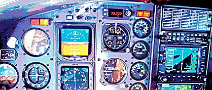
As with most things aviation, RVSM certification isn’t free. Both aircraft and pilots need to be approved for RVSM operation. The most obvious improvement is to altimeters. To qualify for the tighter altitude limits, RVSM aircraft need to mount two independent primary pressure altitude reporting systems (coupled to an air data computer), an altitude alert system and an autopilot certified to tighter altitude hold limits. Static source error correction units (SSECs) also need to be in place to assure accuracy.
Despite the errors inherent in high-altitude operation, the new altimeters must be guaranteed accurate to 25 feet at 30,000 feet in contrast to standard altimeters, which can accept a 180-foot error. Pilots rarely hand-fly aircraft above 30,000 feet, and for that reason, autopilot servos must be more refined, capable of holding an aircraft at exactly the proper height.
 All this avionics innovation translates to a significant expense for regular users of RVSM airspace, primarily the commercial airlines, but also for the corporate sector. To qualify for RVSM certification, a typical Cessna Citation or Lear operator pays between $70,000 and $100,000.
Despite the one-time cost, the benefits of RVSM are considerable. If a controller has two airplanes in an overtake situation at the same altitude, for example, he can merely step up the overtaking airplane 2,000 feet for long enough to get the aircraft by the lead traffic, then drop the new leader back down to its former altitude.
I saw this procedure at work once a few years ago during a return from a Piper Chieftain ferry to Douala, Camaroon, Africa. After the delivery, I hopped on a Sabena Airlines Airbus 330, connected in Brussels to another Sabena 330 flight headed for Boston and was invited up front to the pointy end to ride the jump seat directly behind the captain. We were at FL360 passing south of Iceland when a British Airways 777 (call sign “Speedbird”) came up behind us and was assigned a temporary altitude of 38,000 feet. The BA captain told us this was the first revenue flight of the first British Airways 777.
The Boeing passed almost directly over us, only 2,000 feet above, and the Sabena captain sidestepped his Airbus a few hundred yards to the right and increased power slightly to hold position on the big twinjet. It was truly impressive to look nearly straight up at that beautiful airplane only 2,000 feet away, contrailing huge white streamers of vapor as we flew brief formation seven miles above the ocean. The Sabena captain, a former F-16 pilot, held station just long enough to give his passengers a good look, hoping Iceland Control wouldn’t notice, then reduced power to let Speedbird assume the lead.
In addition to accommodating far more airplanes, adding flight levels 300, 320, 340, 360, 380 and 400 allows qualified aircraft to fly at more-efficient heights and, thereby, save fuel. Airplanes that may be too heavy to climb 4,000 feet under the old rules may be able to manage 2,000 feet. It’s been estimated the fuel savings on North Atlantic routes alone will total $5.3 billion in the first 10 years. RVSM also reduces the need for ATC vectoring, again contributing to fuel savings.
Non-RVSM aircraft can transition through the 29,000- to 41,000-foot block as long as they don’t level off. Above 41,000 feet, airspace returns to the old 2,000 feet of separation.
For their part, flight crews must be educated in the differences between standard and RVSM operation. They need to understand the implications of operating a 200- to 400-ton aluminum tube at closing speeds as great as a mile every four seconds with other traffic only 1,000 vertical feet away.
A number of fine aviation training companies offer transition courses for aspiring RVSM flight crews, but one of the most established is King Schools of San Diego, Calif. King Schools has long offered training in virtually all areas of aviation. Owners John and Martha King operate a Falcon 10 business jet all over the world, and they’ve put together a series of courses intended to ease the transition for a new jet pilot. The Kings’ $199 RVSM course is only one of a half-dozen online classes available for jet pilots from the San Diego school. King CEO Dave Jackson arranged for me to sample the interactive computer RVSM course at www.kingschoolsonline.com. There’s nothing difficult about the material, and most pilots will make it through the course in a little more than an hour.
Reduced vertical-separation minimums represent a more efficient method of operating jets and turboprops in the rarefied sky above 29,000 feet. It’s not for everyone, but for those who make use of North Atlantic and other nonradar airspace, it provides an extra measure of safety and economy.


